Shatha Khalil *
It is no secret that Iran has been working hard to expand into Iraqi territory. Iraqi officials have revealed Iranian plans and intentions to control Shatt al-Arab, the furthest point in the southern Iraq.
The Iraq-Iran border is one of the most important causes of the problems and conflicts in Iraq’s history, since 1937, when Iraq was under British control, an agreement was signed on a certain point in the Shatt al-Arab to draw the maritime border between Iraq and Iran. However, successive governments in Iran rejected this demarcation and considered it an “imperialist”. Iran considered the point of the bottom line in the Shatt al-Arab, which was agreed in 1913 between Iran and the Ottomans as the official border and the point of the bottom line is the point where the Shatt is in the most cases of decline.
In 1969, Iraq informed the Iranian government that the entire Shatt al-Arab was Iraqi waters.
On March 6, 1975, the Algiers agreement was signed between Iraqi Vice President Saddam Hussein and Iran’s Shah Mohammad Reza Pahlavi under the supervision of President Houari Boumediene .
The agreement included the passage of the border between Iraq and Iran at the deepest point in the Shatt al-Arab, represented by the Taluk line (the point at which the shatt is in its most severe decline), generally in the middle of it .
But Saddam Hussein abolished this agreement in 1980 after the fall of the Shah and Khomeini’s accession to power, which sparked the first Gulf War.
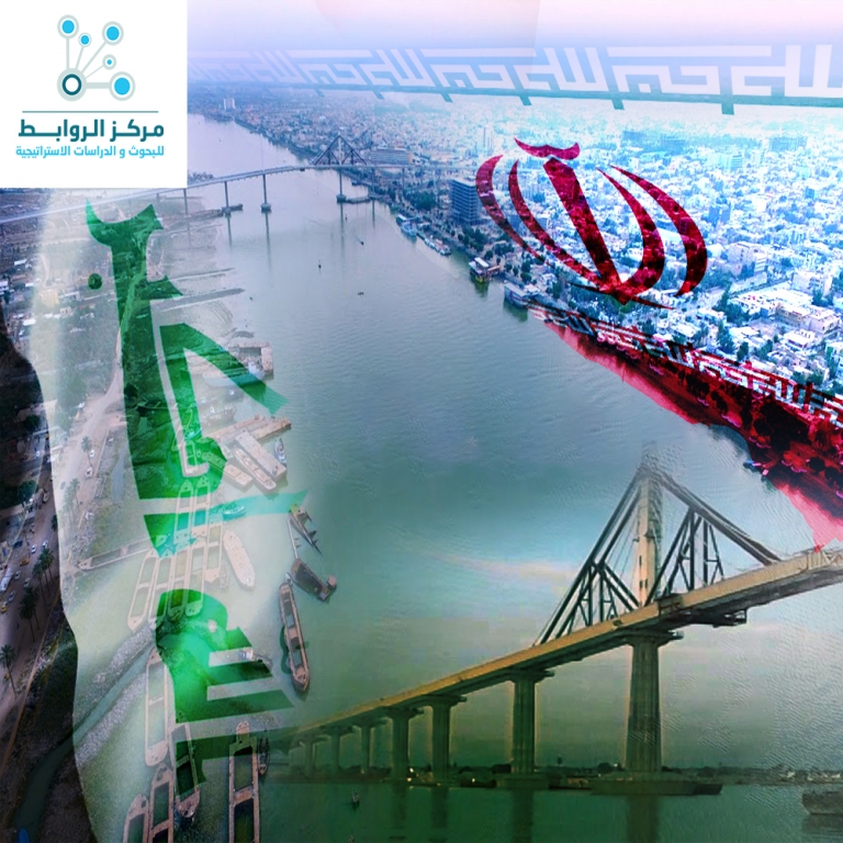
The Shatt al-Arab consists of the confluence of the Tigris and Euphrates Rivers. The length of their meeting with the town of Qurna to its estuary in the Arabian Gulf at the town of Faw is approximately 180 km, and its width of the passage is between 1-2 km, and about half of this distance, Shatt al-Arab is running in Iraq and the second half Becomes a dividing line between Iraq and Iran starting from Khor Ramshahr, which is located east of the city of Basra by 30 km, where the river Qarun cast in it.
And a branch called Khorbhamanshir comes out from it and between the two branches there was a wide land called Abadan island and there are several islands in the watercoarse of the Shatt al-Arab, which is navigable and the ships enter to it up to the city of Basra, and the Iraqi railway lines end in Basra, and then transport the goods to the waterways , and the oil pipelines reach to FAO, but to the end of Khor al-Amaya south of Faw and within the waters of the Arabian Gulf.
Shatt al-Arab, which is about 200 kilometers long, is an important artery for Iraq economically. It is the navigational channel for ships heading to the ports of Basra from the Arabian Gulf and a major source of irrigation of palm groves in southern Iraq.
The Taluk line is the dividing line between Iraqi and Iranian waters under the Algiers Agreement of 1975. The Iranian coast begins on the Shatt al-Arab from the island of Umm al-Rasas to Ras al-Bisha, where the estuary of Shatt al-Arab is located in the Arabian Gulf.
The eastern banks of the crucial, border-defining Shatt al-Arab waterway are washing away, which means a slow loss of land mass for Iraq noting that the eastern bank of the Shatt al-Arab is constantly eroded due to neglect, the abundance of muddy water, the siltation of the Karun River and the Iranian Bhamshar trench, and the diversion of its watercourse inside Iraqi territory, causing the loss of land in favor of Iran. Some fear that Iran may unfairly benefit from the development as the borders of it creep to the inside of Basra by deducting new areas of Iraqi territories and member of the maritime center Amer Adnan said that Iraq is losing about 100 dunums annually from its national territory to Iran by moving of the Taluk line , which divides the river at the middle between the two countries, towards the Iraqi territorial waters continuously.
Adnan said that the diversion of the Shatt al-Arab in the estuary area at a sharp angle towards Khawr Abd Allah led to the addition of new sedimentary lands to the Iranian side at the expense of the Iraqi side, especially with the absence of irrigation operations of the river.
Adnan warned that the continuation of this diversion in the watercourse of the Shatt al-Arab will lead to the fall of Iraqi oil ports in the Arabian Gulf as the port of Basra and the port of Khor al-Amia within the territory of the Iranian side and deprives Iraq of any sea view .
Iran has three ports in the Shatt: the port of Khorramshahr, which has expanded significantly, and the ports of Abadan and Khasroabad. It has also established three other ports: Arvand Canar, Baal Basset, Arfand yek and constructed new naval platforms.
According to Professor of Geography at the Faculty of Education at Muthanna University Dr. Sarhan Al-Khafaji, saying: owners of orchards in Abu Al-Khasib region complain of carving, erosion and collapse of large areas in their orchards and agricultural lands overlooking the Shatt al-Arab.
Al-Khafaji explained that the flow of the steep Karun river in many areas of the Shatt al-Arab led to the emergence of land areas in the eastern bank , which belongs to the Iran , and this led to the erosion of the Iraqi shelf, and caused the disappearance of large tracts of agricultural holdings, and erosion in some areas has reached public roads, increasing cracks and fissures that indicate the banks are likely to slide towards the watercourses and erosion in some areas are increased , especially in Tanawmah (Shatt al-Arab district). ”
Al-Khafaji ‘s study of the river’s changes indicates that it is tending to rearrange its course in line with the construction and demolition processes on both sides,”.
It is clear from the comparison of the annual construction and demolition rates for the period (1952 – 2009), the annual rate of construction declined as the demolition rate increased, especially in the Iraqi river bends in (20) points of Qurna north to the estuary, while the river tongues are a new land built by the river through its lateral movement on the left bank within Iranian territory. ”
This means that the region is affected by tectonic movements as they occur near the edge of the unstable Iranian plateau, which has affected the side river movement towards Iraqi territory.
Khafaji added : ” The areas where the Shatt al-Arab is going through are sliding down from east to west with two degrees in its eastern sections, while the slope declines to one degree in the sections overlooking the riverbed ,” .
In order to solve this crisis, Al-Khafaji proposes to the concerned parties lining the banks of the Shatt al-Arab River with stone barriers when it is twisted and laying stone tongues because it “will prevent the effect of river erosion activity and work to strengthen the natural river beds and the use of stone heads to stop drifting and but new laws are also needed to protect the rights of agricultural landowners whose properties are exposed to the erosion and find appropriate solutions through the amendment of some of the provisions of the laws of agrarian reform for that.
“The erosion of the Shatt al-Arab requires a large and sophisticated handling ,” said Basra Provincial Council member Zahra al-Bajari. And indicating that “There are efforts to form a committee composed of members of the provincial council, the province’s bureau and water resources directorate in Basrah to discuss this issue and consult with the Ministry of Water Resources to make the appropriate decisions.”
Many officials are demanding the reconsideration of the 1975 Algiers Agreement between Iraq and Iran because they say that it failed to adequately observe Iraq’s water rights and gave Iran rights in the Shatt al-Arab at the expense of Iraqi territory.
Geological expert Amran al-Khalidi said that the impact of erosion due to the intensity of the water sloping towards Iraqi territory, “requires the establishment of a rocky area on the banks of the Shatt al-Arab, and work to strengthen the shoulders of the river with strong materials to prevent the erosion of land.”
Al-Khalidi added that “the ongoing land- erosion operation enables Iran to extend its control and domination of the Iraqi commercial and oil ports, so it requires from the Iraqi government to find quick and developed treatment to stop Iranian expansion in Iraqi territory.”
And about the Iranian movements to change the borders between the two countries , the civil activist Salam Abdul Hussein said “We have noted moves made by Iran to promote a new name for the Shatt al-Arab in the Persian language (Arvand Rud River), which reflects its intention to extend its control over the river in order to control Iraqi commercial and oil ports so as to control them later on ,” . , Although the name Shatt al-Arab is written and fixed in all maritime Admiral maps , which is the reference source in the documentation of geographical features and navigational routes in the oceans, seas and rivers.
“Iraq annually loses thousands of meters of its territory to Iran as a result of negligence, which can control the entire Shatt al-Arab and achieve what it has been seeking since the time of President Saddam Hussein,” said a source in the Iraqi navy in Basra province, who declined to be identified.
The source added that “the phenomenon of sedimentation and sediment caused a lot of change in the paths and corridors of Iraqi navigation in the Shatt al-Arab, and allowed the Iranian coasts to expand at the expense of the decline of the Iraqi coast,” noting that “the authorities that are responsible for Iraqi ports on the Shatt al-Arab provided the Iraqi government with more reports of the Iranian expansion.”
He pointed out that “the flow of the waters of the Shatt Karon ,that are very steep in many areas in the Shatt al-Arab, led to the emergence of land areas in the eastern bank of Iran,” noting that “a change in the course of the Iraqi navigation corridor in the Shatt al-Arab, gives Iran arguments and geographical and hydrographic pretexts to control Iraqi ports. ”
We conclude that Iran is continuing to wage war to acquire Iraq’s water and oil resources and is exerting all means to expand its borders and the territorial waters of Iran by aggression on Iraq’s borders and resources. It has changed the course of many Iranian rivers and increased its territorial waters at the expense of Iraq and seeks to deduct more of Iraqi territories, and the theft of its oil wealth in ways to control the entire Shatt al-Arab.
Observers warned that a change in the course of the Iraqi navigation corridor in the Shatt al-Arab, gives Iran arguments and geographical and hydrographic pretexts to control the Iraqi ports, as it continues to erode the land to extend control and dominate of Iraqi commercial and oil ports.
Economic Studies Unit
 Rawabet Center for Research and Strategic Studies