The problem of the border between Iraq and Kuwait dates back to the early 1930s when Britain asked Iraq to demarcate the border with Kuwait in order to gain independence and join the League of Nations. In 1932, Iraqi Prime Minister Nuri al-Said sent a letter to the British authorities on July 21 1932 includes a detailed description of the land border between the two countries, and the area of Al-Mutlaa is the border with Kuwait.
Continuation of border problem
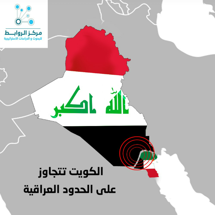
The problem of the maritime and land borders between Iraq and Kuwait continues to cast a shadow over the course of relations between them and with the Gulf States due to the consequences of investing the results of the Second and Third Gulf Wars in 1991 and 2003 in favor of Kuwait in imposing its point of view and interests in demarcating its border with Iraq especially in the expansion of its control over the waterfront in Iraqi Khor Abdullah which was confirmed by a UN committee in international resolution No. 833 of 1993.
The territorial waters of the riparian States of the north of the Arabian Gulf are interrelated and have certain specificities where it is difficult to apply the 1982 United Nations Convention on the Law of the High Seas without the agreement of all the concerned states.
Law of the High Seas 1982:
The United Nations Convention on the High Seas of 1982, known as the High Seas Act of 1982, is one of the most important international legal references governing the rules relating to marine areas under the territorial jurisdiction of coastal States and marine areas beyond the territorial jurisdiction of coastal States in its simplified and comprehensive form.
Article XI of the United Nations Convention on the High Seas of 1982 reiterated Article VIII of the Treaty on the Territorial Sea to consider the most remote parts of permanent facilities in ports to be an integral part of it and thus subject to its legal system where it provides: “for the purposes of delimitation of the territorial sea, the utmost permanent harbor works which form an integral part of the harbor system are regarded as forming part of the coast. Off-shore installations and artificial islands shall not be considered as permanent harbor works. ”
This has not been taken into account in the demarcation of the maritime boundary between Iraq and Kuwait. This is evidenced by the fact that the mandate of the Commission delimits international borders as defined by the Security Council itself in resolution 687 (1991) and the report of the Secretary-General in accordance with paragraph 3 of that resolution, it did not entitle the commission to deal with the coarse of boundary for any connection of khor al-Zubair with khour Abdullah (Ie, beyond that point to the sea) unless the parties (Iraq and Kuwait) agreed otherwise and that the Commission could not have extended the limits of its mandate on its own responsibility without the Kuwaiti, American and British pressures that were exercised on the International Commission for the demarcation of maritime boundary .
Here, it should be clarified that the common maritime areas between Iraq, Kuwait and Iran have not yet been subject to a joint agreement on the exploitation of the continental shelf, the adjacent area and the exclusive economic zone, as well as the fishing and maritime trade zones as each of these areas represents resources that don’t drain easily , and due to the interrelation of these areas among them for the three countries , it will be necessary to seek common exploitation of it for the benefit of all.
Observers confirm that the crisis continues between Iraq and Kuwait after the Iraqi ratification on the navigation convention with Kuwait in Khor Abdullah, on the land and sea borders, because of the bias of the Security Council in favor of Kuwait, without taking into account Iraq’s economic and strategic interests.
The former MP, Judge Wael Abdul Latif, revealed important facts to confirm Kuwait’s seizure of Iraqi land and water.
* Kuwait took Umm Qasr naval base.
* Kuwait took Iraqi territory with a depth of 10 kilometers and a length of 60 kilometers which is a strategic reservoir of Iraqi oil.
* Take the village of Umm Qasr.
* Kuwait took Iraqi Khor Abdullah, which has never been a Kuwaiti port.
* Kuwait took three oil fields of Iraq, namely: Upper Sejail the Dome of Safwan, Dujail.
Khor Abd Allah: it lies in the northern Arabian Gulf between the Kuwaiti islands of Boubyan, Warba and Al-Faw Peninsula, where the Iraqi government has laid the basic structure for the construction of the port of Faw.
Khor Abdullah extends along Iraqi territory, forming Khor al-Zubair, in which the Iraqi port of Umm Qasr is located ,
Umm Qasr is an Iraqi city located in the southernmost part of Iraq within the province of Basra and includes the port of Umm Qasr, which was built in 1958 and before the construction of port, it was a small village where its inhabitants are fishing fishes .
In the second Gulf War, Umm Qasr suffered heavy shelling, paralyzing the movement, and built a fence between Iraq and Kuwait in the center of the small city so Iraq lost control of the entrance to the port, which was under Kuwait’s control.
In the invasion of the International Alliance of Iraq 2003, Umm Qasr was one of the first to be attacked by coalition forces and was taken over by British naval forces after fighting with the Iraqi army for several days.
It should be recalled that the Security Council, in resolution 660 (1990), called upon Iraq and Kuwait “to begin immediately intensive negotiations to resolve their differences”, including the resolution of the most important border issue, and under the provisions mentioned in the above resolution, the Security Council adopted a completely different procedure to the resolution 660 (1990)! When the Security Council dealt with the question of borders under Chapter VII of the Charter, through section (a) of resolution 687 (1991), not only by imposing the “delimitation formula” but also by imposing the “bases” of delimitation, For this reason, Cuba voted against resolution 687 (1991) while Ecuador and Yemen abstained.
Resolution 687 (1991), which outlined the limits set out in the letter of the Prime Minister of Iraq dated 21 July 1932 and approved by Kuwait in the letter of 10 August 1932, demanded that Iraq and Kuwait respect the inviolability of international borders and the allocation of islands, In the “Agreed Minutes between the State of Kuwait and the Republic of Iraq on the Restoration of Friendly Relations, Recognition and Related Matters”, signed by them, in exercise of their sovereignty, in Baghdad on 4 October 1963; and registered with the United Nations; it provided in one of its operative paragraphs the following “Requests the Secretary-General to assist in making necessary arrangements with Iraq and Kuwait using the appropriate materials , including the maps annexed to the letter dated 28 March 1991 from the Permanent Representative of the United Kingdom of Great Britain and Northern Ireland to the United Nations, and to report to the Security Council thereon within one month”.
The Security Council allowed itself to intervene in the issue of the border between Iraq and Kuwait through section (a) of resolution 687 (1991), not through a “delimitation formula” by imposing “foundations “and “way” of the “demarcation”.
Although the powers and functions of the Security Council under the Charter do not grant it the right to impose a process of delimitation on a Member State because that power is subject according to the international law to the rule of agreement between the States concerned ! More precisely through dialogue and direct negotiations between Iraq and Kuwait.
The UN Security Council formed a committee to demarcate the Iraqi-Kuwaiti border from five members in accordance with Resolution 687 (1991), two representing Iraq and Kuwait and three independent experts selected by the Secretary-General of the United Nations, one of whom is the Chairman of the Committee. The decisions are taken by the voices of the majority and these decisions are final and the committee is accountable to the Secretary-General.
Iraq noted that those proposals did not provide a full balance between views that might be adopted by each party during the demarcation process and that, as long as it had no role in selecting experts, it would not be able to pre-assert the fact of their independence.
Hence, its opinion in the context of the demarcation process will be represented by only one member out of five members who are realistically from the international coalition.
Security Council
The Security Council, on the basis of the demarcation of borders, imposed the use of the term “appropriate material”, including a British map drawn up in 1989-1990 by the Director General of the United Kingdom’s Military Survey, and was adopted by the Security Council as a document at the request of the Permanent Representative of the United Kingdom to the United Nations in its letter of 28 March 1991, five days before the adoption of resolution 687 (1991).
Notably there is no legal basis for Iraq’s non-involvement in its drawing, non-recognition or approval in any way , so legally the Security Council can not adopt the “map” referred to in resolution 687 (1991) as the basis for demarcation.
Therefore, the inclusion of the map by the Security Council in the appropriate article for the purposes of demarcation would mean a pre-conceived judgment on the route of the boundary line on the ground and prior to the demarcation process against the interests of Iraq without any basis or legal consideration for the adoption of a map drawn up by the Director General of the United Kingdom ‘s military survey in 1989-1990, and it was better and more lawful “to adopt maps or drawings drawn or shared by the concerned parties in demarcation, Iraq and Kuwait.
The process of demarcation of the maritime boundary between Iraq and Kuwait was discussed by the ICRC established pursuant to paragraph 3 of resolution 687 (1991), issued by the Security Council at its 3rd meeting, held in Geneva from 12 to 17 May 1991.
During the discussion, the Chairman of the Committee Mukhtar Kusuma Atmaga (Indonesia) expressed his view that, given the nature and extent of the Commission’s mandate, it would be difficult to deal with demarcation of the maritime boundary.
This is due to the fact that the said mandate did not authorize the Commission to deal with the border route beyond the point of connection between Khor al-Zubair and Khor Abd Allah (ie, beyond that point to the sea) unless the parties (Iraq and Kuwait) agree otherwise and the Commission was not able to expand the limits of its mandate on its own responsibility.
The Chairman of the Committee did not hesitate to reveal the Kuwaiti pressure on the work of the Committee and intervene in it, which was exercised on the Assistant of the Legal Advisor to the Secretariat of the United Nations, and the two neutral experts in order to get them to adopt Kuwait’s position regarding the demarcation of the maritime border.
As its work was taking place in special circumstances following Iraq’s invasion of Kuwait and in accordance with resolution 687 (1991) and the report of the Secretary-General of the United Nations on the implementation of paragraph 3 of that resolution.
The text of resolution 733 (1992) and the basic factual information of the Committee’s discussions unequivocally reflect the organized and coordinated efforts of Kuwait and certain secretariats, as well as certain Member States of the Security Council (the United States and Britain) to guide the work of the Committee contrary to the mandate given to it as defined by the Security Council itself in resolution 687 (1991) and the report of the Secretary-General in accordance with paragraph 3 of that resolution.
That effort led to the reported result without a clear modification of the mandate of the Commission, as this would be a clear political and legal scandal.
The Chairman of the Committee, Mukhtar Kusuma Atmaja (Indonesia), announced his resignation on 20 November 1992 in his letter addressed to the Secretary-General of the United Nations, stating that the reasons were “personal” and the other, according to the text of the letter, “he has had Reservations since some time on the terms of reference to the Committee “In his letter, the Chairman of the Committee said how he had raised , on several occasions with the Legal Counsel, some aspects of the conditions of recourse to the Commission and how he had drawn attention to the fact that the boundary in the sea section (Khawr Abd Allah) was not referred to in a precise description of the boundary as contained in the exchange of letters of 1932, and therefore the appointment of borders was not available “for the Commission ,on which the basis of the demarcation of the border can be made on this part of the process.”
He disclosed how the Legal Counsel had explained to him in April 1992 that “any change in the Commission’s mandate on the part of the Security Council was beyond the bounds of this issue”.
The letter noted that this issue was discussed again between the Chairman of the Committee and the Legal Counsel in May and was again discussed in two meetings held between the Chairman of the Committee on the one hand and the Legal Counsel and the Secretary-General on the other in July and September 1992 when the Chairman of the Committee confirmed that he could not continue to work Unless there are amendments to the Commission’s mandate. ”
Then Nichlas Valtekos was appointed as the chairman of it and the sixth meeting of the Committee was held in Geneva from 14 to 16 January 1992. The Committee adopted a quick resolution confirming that the fundamental principle governing the demarcation process in Khor Abdullah should be the line passing through the center , it is to mean that the objective and purpose of the border settlement is to facilitate the passage of maritime navigation to both parties.
Legal Violations of border demarcation
The intervention of Kuwait and the American administration and the British government in the work of the Committee and pressure is a legal irregularities, led to a result raises a number of legal questions, can be summarized as follows:
The demarcation formula adopted by the Security Council as the basis for the demarcation of the border in resolution 687 (1991), which was expanded in the report of the Secretary-General of the United Nations submitted in accordance with paragraph 3 of the resolution, does not contain any reference to the demarcation of the boundary in Khor Abdullah.
On this basis, it is impossible to rely on that formula for any demarcation of boundary of the type by which the Commission has been drawn because the demarcation should be based on a description of the boundary, that is, the delineation of agreed boundaries by the parties concerned.
Khor Abdullah can not be of the same nature of the territorial sea waters on the basis of the delimitation process approved by resolution 687 (1991) in order to enable the application of the rules of the law of the sea in the division of maritime areas between States with opposite or adjacent coasts.
The two neutral experts in the committee confirmed that the Khor Abd Allah area is part of the regional maritime zone and is subject to the concept of “special circumstances” between the parties. Therefore, the rules that can be applied in the absence of “special circumstances gains special power for the benefit of Iraq because there is no formula greed on the delimitation of the boundary between Iraq and Kuwait in Khawr Abd Allah, in other words, that the process of demarcation in that area was being conducted for the second time and thus the special circumstances rule could be applied.
Iraq confirms that it has historical rights since 1870, in the area of Khor Abdullah, where Kuwait did not carry out important navigation operations, and therefore the region lies outside the framework of the application of the rule of the line passing through the center in accordance with Convention on the Law of the Sea of 1982.
For decades, Iraq has spent millions of dollars on operations of Irrigations, expanding and maintaining navigation routes, major and secondary channels leading to and passing through Khawr Abd Allah and setting up ports and marinas in the region to ensure that its trade flows into the sea.
The imposition of borders on the Khawr Abd Allah in the manner used by the Commission constituted a serious denial of Iraq’s historical right to free access to the sea through safe and unrestricted navigation operations in Khawr Abd Allah and to the extent that Iraq effectively becomes a closed land state.
The most important damage to Iraq from the demarcation of the maritime border with Kuwait by the International Boundary Demarcation Commission established in accordance with section (a) of resolution 687 (1991) which ensure the results of its work include UN Security Council Resolution 833 of 1993, and the most important of them are :-
• Iraq’s loss of vast oil-rich land and its only naval base overlooking the Arabian Gulf, namely, the Arabian Gulf base at Umm Qasr, with all its marinas, ports and sea entrances because of its annexation to Kuwait, as well, according to Security Council resolutions that deprived Iraq of its only view of the Arabian Gulf where Kuwait’s seizure of the navigational corridor in Khor Abdullah caused to disrupt the work of several Iraqi ports such as the ten berths, petrochemicals, Khor al-Zubair port, iron and steel and finally the commercial and oil ports in Umm Qasr.
• The border line in its current form, which is drawn on the maritime maps, cuts the entire Iraqi navigational corridor, extending from the southern edge of the Arabian Gulf base (Al Maslouba) to the other Iraqi side of the Gulf, and approaching the island of Hjam, so that it touches the lower part, it means that the approaches of the island (Hjam) itself became part of the property of Kuwait.
• When Iraqi and non-Iraqi ships leave Umm Qasr harbor towards the sea, several meters , it would have entered Kuwait’s territorial waters, this means that Iraqi vessels must raise the Kuwaiti flag and request permission from the Kuwaiti government when moving from Umm Qasr to FAO. And the foreign ships coming to Iraq, it is likely that Kuwait will allow it to exercise the so-called right of innocent passage or the right of transit, which deprives Iraq in light of the new features of any sovereign port on the sea.
• According to the United Nations Convention on the High Seas, Iraq has become a geographically affected country with a very limited geographical area of no more than 29 nautical miles (57 km) starting from Ras al-Bisha to Umm Qasr, while the distance between the creeping borders to Iran and Kuwait was reduced to less than 18 nautical miles, which resulted in the accumulation of Iraqi ports (fertilizers, oil, iron, steel, petrochemicals and public goods) in one limited and narrow area.
• The entire navigational channel has become part of Kuwait’s territorial waters as Kuwait has acquired the entire navigational channel, which means that Iraq has become completely isolated from the international maritime areas after Its maritime port has become under the influence and sovereignty of the Kuwaiti government and Kuwait may impose on the local and foreign ships to raising Kuwaiti flag, and obtain the prior permission of the Kuwaiti Navy authority to enter and leave.
• This is what the Kuwaiti warships in charge of the deep reconnaissance in Khor Abd Allah began to implement. They have always issued their firm appeals to the ships’ captains heading to the Iraqi ports, forcing them to lift the Kuwaiti flag and take down the Iraqi flag by force. Thus, Iraq lost its sovereignty over its maritime ports under the border established on the Admiral Navigation Maps.
• Kuwait has chosen to implement its port of Mubarak al-Kabir in 2005 in the narrowest areas, and to establish it directly in the coast of Faw on the eastern coast of Boubyan Island, to suffocate the only marine larynx that Iraq breathes in this sensitive location, which intercepts ships heading to ports of Iraq, and insists on imposing geopolitical reality in the region which is one of the most difficult navigational areas in the world, as if to close the last remaining port gates of Iraq, and thus deprive Iraq of its maritime connections. And the question is about the real motives behind the establishment and construction of this port in this particular site (Boubyan Island), and in these sensitive conditions experienced by the region,
Although the Kuwaiti coastline is 499 kilometers long, the length of the distance between Basra and Baghdad, and spread along its coasts of specialized ports in Shu’aybah, Al-Ahmadi, Doha, Shuwaikh and Qulaia, and then have a large range of ports and deep berths?
The motives of building the Mubarak Al Kabir Port and its consequences
• The port will neutralize Iraqi ports (fertilizers, oil, iron, steel, petrochemicals and general goods) and exert pressure on them. The facilities and works of this port will affect Iraq’s territorial waters.
• Building a project of such magnitude will have a direct impact on the Iraqi economy. Iraqi ports will lose its normal business with international maritime shipping lines, and thus the loss of thousands of Iraqi workers working in these ports.
• The extensions resulting from the berths of this provocative port according to the phases of the project will certainly damage the area of the Iraqi continental shelf that has not yet been determined or agreed upon.
• Drilling and reclamation, and the construction of concrete barriers in Khor Abdullah, will damage the fisheries in Iraqi territorial waters, which are the livelihood of thousands of southern residents.
• Aborting the Iraq Grand port project or the grand port of Faw, and bringing in Arab and foreign investments and funds to be used in Boubyan Island so that there would be no economic feasibility from the establishment of the port of Faw.
The expert, Rear Admiral Dr. Emad Alo said that the port will hit the environment a lot of damage due to the waste resulting from the project, the ships anchored therein, or from the service projects to be attached to the port.
Wael Abdel Latif said that the Kuwaiti debts on Iraq is corrupt; Iraq should not abide by it; the end of the Second Gulf War and the exit of Iraq from Kuwait and the fall of the regime of Saddam Hussein, who entered Kuwait contrary to the opinion of the Iraqi people.
He called on Kuwait to be aware of Iraq’s interest in this agreement as long as it is an Arab country and neighbor and open the door to dialogue with Iraq and remove the state of tension by finding a way to preserve the right of Iraqis and their interests as long as there is no broad and deep outlet that Iraq can be linked to international maritime navigation, and on the contrary ,the region will remain a focus of conflicts and disagreements that will lead to wars and destruction in the end.
Shatha Khalil
Economic Studies Unit
Rawabet Center for Research and Strategic Studies